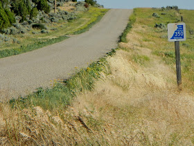
 Sunset was around 8pm, so after dinner we decided to go on a short gallivant; check out some of those county roads north of Highway 491. 5.1 miles - CR 308 (Hallers); South on Hwy 491; directly across and North on Hwy. 491 is CR 362; 1/2 mile north on CR 362, turn east onto CR 335 (North Old Highway).
 Here's a map to help follow our little drive.
There are alternative county roads to access CR 335 from Hwy. 491:
 |
| Eastland Tower in far background. |
 CR 335 is one of those pretty, scenic roads where you don't mind taking your time as you drive along; definitely a good way to relieve any stress tension and get into relaxation mode.
 Except if you're me; my excitement comes when I find old homesteads, cabins, barns, even windmills. They tell stories of when the pioneers and ranchers first began to settle the Old West. I do get disappointed when I can't find the owners around, and ask if I can explore and take photos; sometimes they even give me a verbal history about the buildings.
 |
| Old Planks. |
 Before we knew it, we'd reached CR 370 (Ucolo); we went only about a mile north and found this old tree house in a field. There was an old foundation too, but really nothing else left of whatever building(s) had once been. Up ahead we saw modern day homes, barns, farm machinery; and they just weren't that interesting; so we turned around and decided to take the southern end back to Highway 491.
Jackpot! More old homesteads, plank fencing, pieces of farm equipment; a photographer's paradise.
Homestead #1
 |
| Farm Equipment Lying About. |
 |
| Fencing made from Planks. |
Almost to Hwy 491, we were graced with a raven in flight.
Before going directly home though, we visited Shake Shack; Roy's favorite is pineapple, and I love the mint; perfect ending to a perfect gallivant.
Oh, one side note: we also found out that Utah Highway Patrolman, Sanford Randall, was able to find our friend's camera that had gotten lost at the Blanding 4th of July Parade. Ivy Kropf happens to be Amy Watkins Kensley's sister; and since the Watkins family adopted Roy and myself, well they're our sisters too. Anyway, all's well that ends well.
Mary Cokenour
Mary Cokenour


